Selected Exhibits
Μaps
-
- The islet and the fortress of Spinalonga in a design by Francesco Basilicata (1618). © “Micros Nautilus” Publications – Vikelaia Library – Local Union of Municipalities and Communities of Crete
-
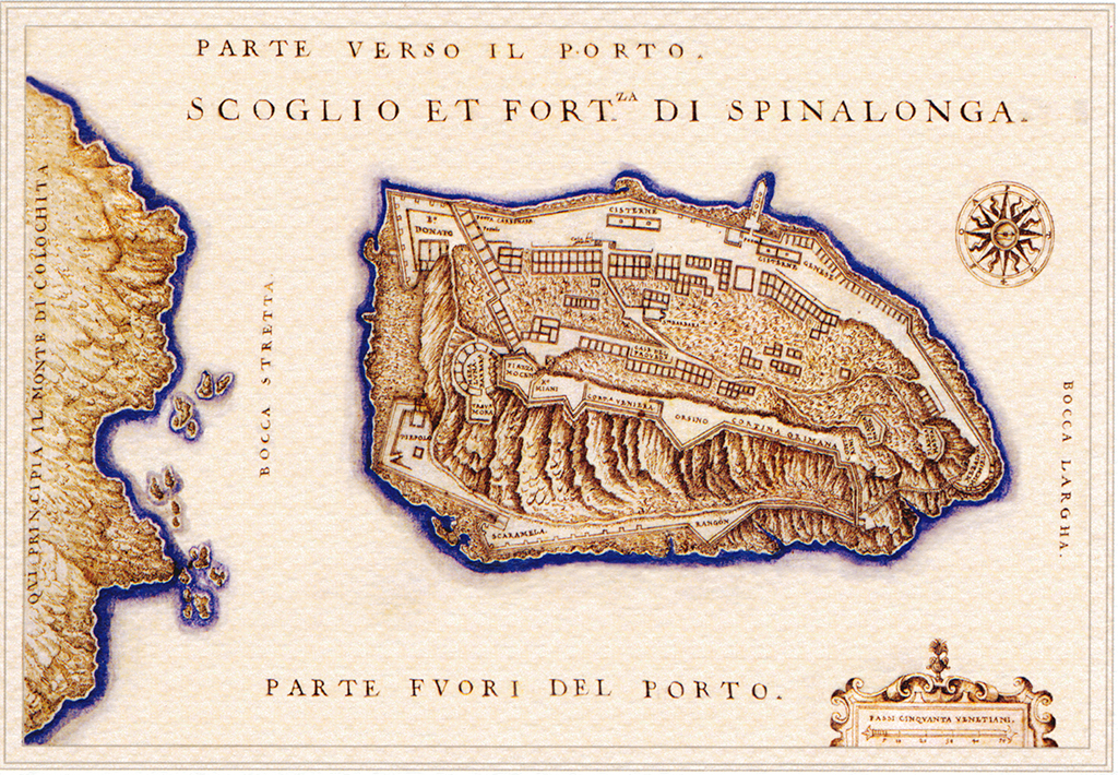
- The island of Spinalonga and the homonymous fortress (Scoglio, et Fortezza di Spinalonga). Map of Francesco Basilicata, 1618. ©”Micros Nautilus” Publications – Vikelaia Library – Local Union of Municipalities and Communities of Crete
-

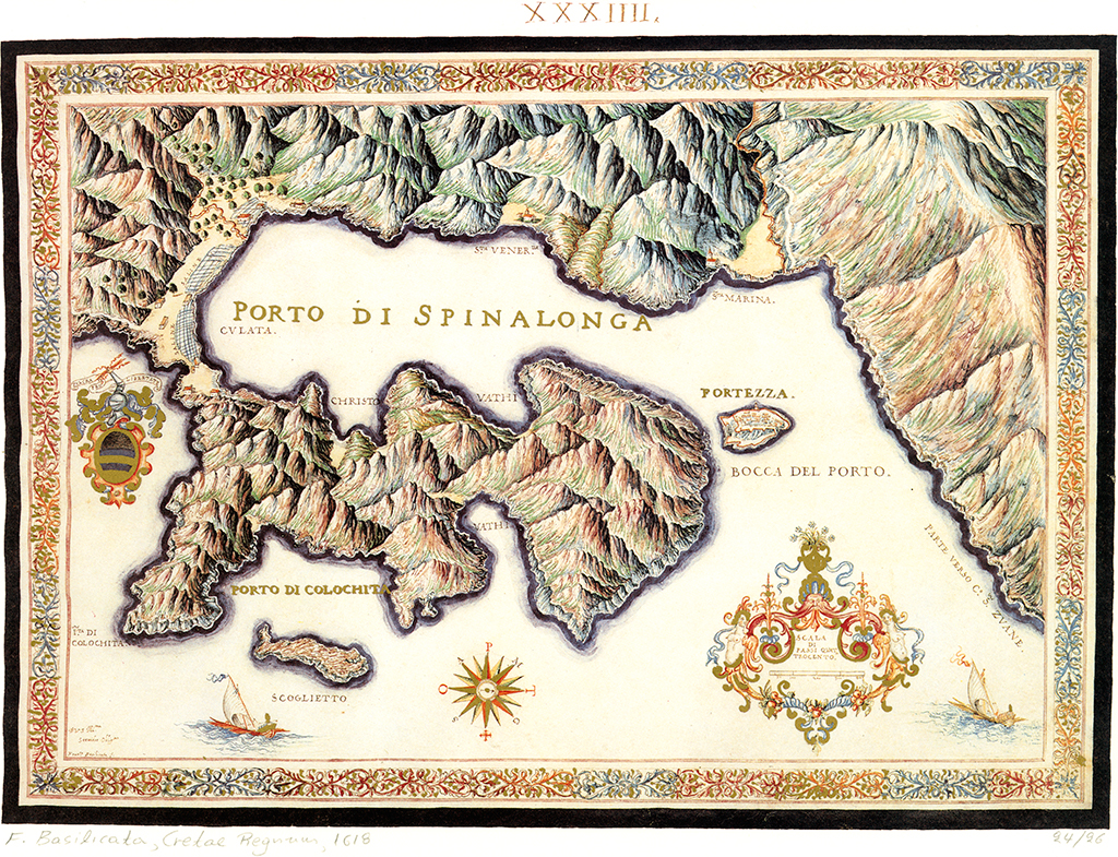
- The port of Spinalonga (Porto di Spinalonga). Map of Francesco Basilicata, 1638. ©Mikros Nautilus Publications. Heraklion
-
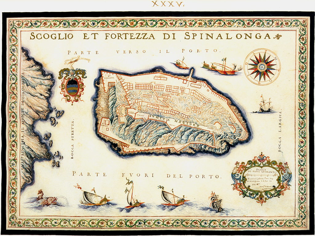
- The islet and the fortress of Spinalonga (Scoglio et Fortezza di Spinalonga). Map of Francesco Basilicata, 1638. ©Mikros Nautilus Publications. Heraklion
-

- The plan and western aspect of the fortress in a design by the French-born chief engineer Filippo Besseti di Verneda (1653), which includes abundant information about the fortifications and premises of the island. ©Bibliothèque Nationale, Paris
-

- The fortress of Spinalonga (Fortezza di Spina Longa). Map of Marco Boschini, 17th century. ©https://www.europeana.eu/item/447/GEO0016320